When Severe Weather Could Interrupt Friday Plans
A significant day of severe weather, including the threat of a strong tornado or two, is ahead from the Midwest to the Central Plains as this week of strong thunderstorms across the country’s mid-section continues. The Storm Prediction Center updated their outlook this afternoon to include a level 4 of 5 risk of severe weather for a region in the Plains from Oklahoma into Kansas and Missouri.
Multiple tornadoes have already been confirmed. A tornado flipped a semi-tractor near Elgin, Minnesota, and caused damage on two farmsteads. Another tornado damaged homes in Marion, Minnesota, in the Rochester area.
Happening Now
We already have had severe t-storms this morning in parts of Minnesota with quarter size hail reported in Kasota and New Ulm. Tennis ball size hail fell this afternoon near Tama, Iowa, or between Des Moines and Cedar Rapids.
(Live Updates: News And Reports From The Severe Weather)
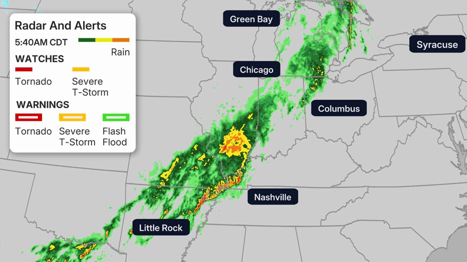
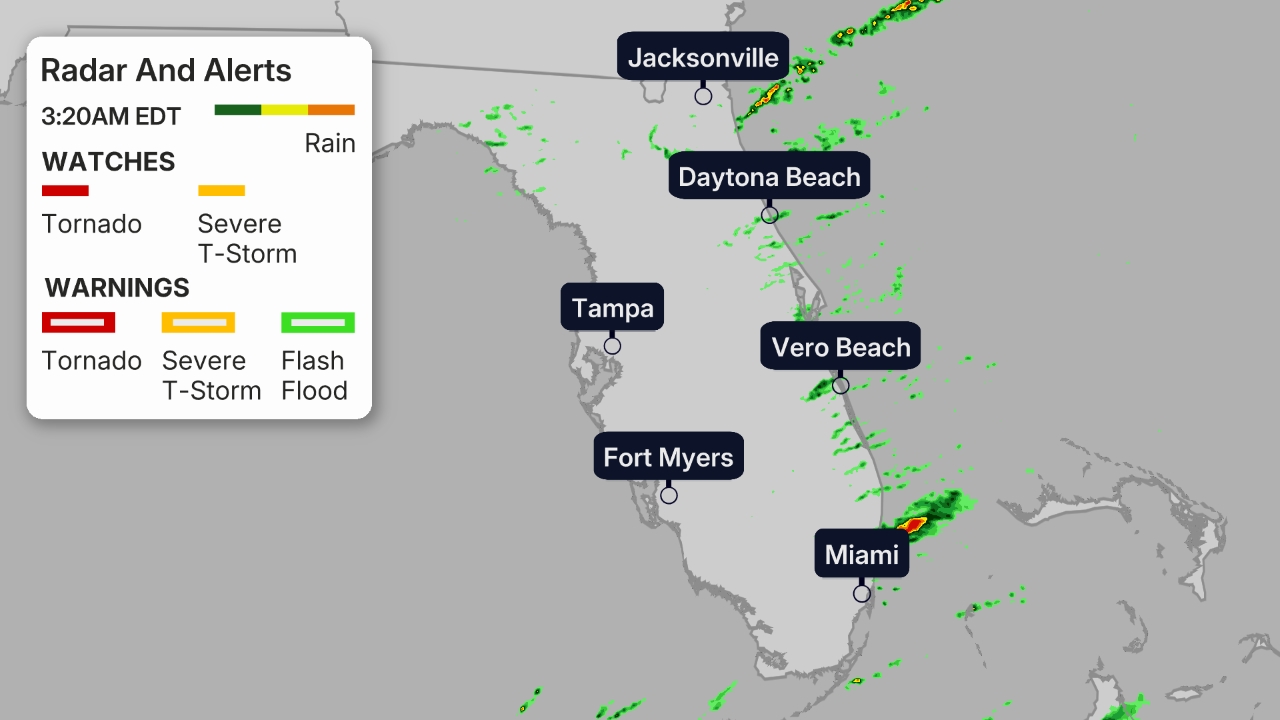
The maps below show the current radar, along with any watches or warnings currently in effect.
Tornado watches have been issued from Oklahoma to Wisconsin, and multiple tornadoes are likely as well as widespread hail up to softball size and damaging wind gusts up to 70 mph.
There is an increased tornado threat across southern Wisconsin and northern Illinois over the next couple of hours, including around Milwaukee. A tornado has been confirmed north of Rockford, Illinois.
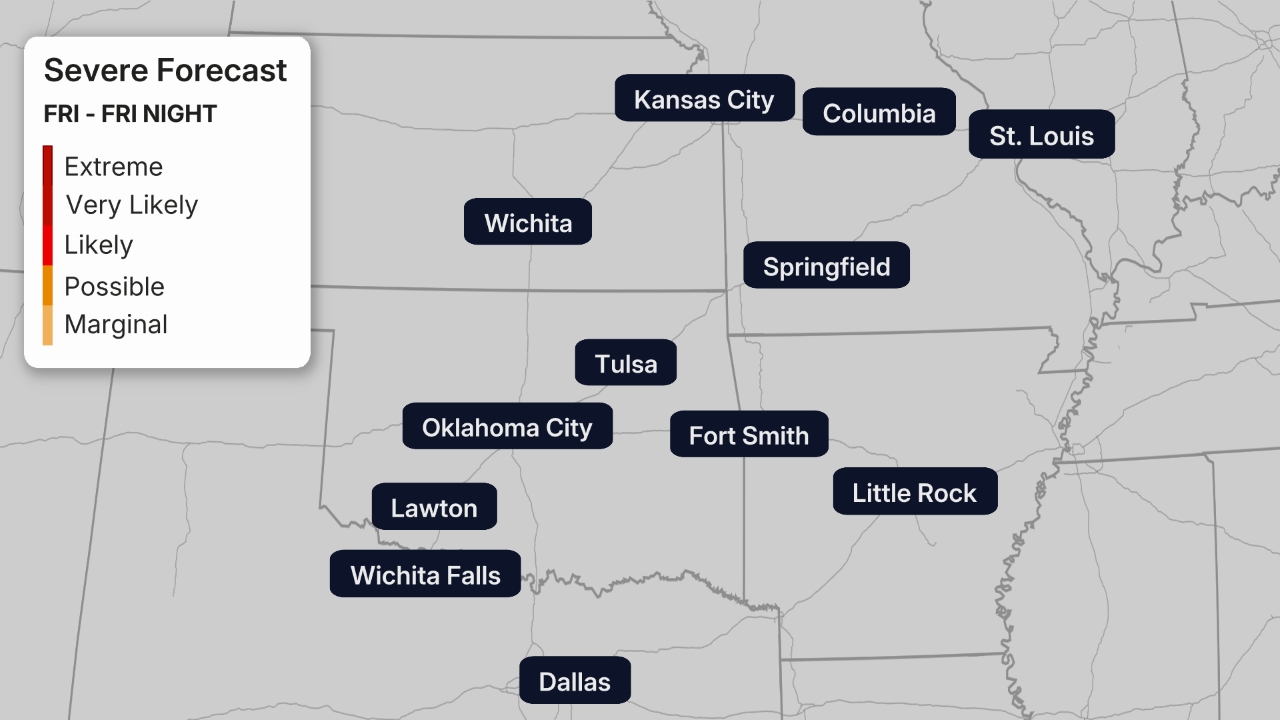
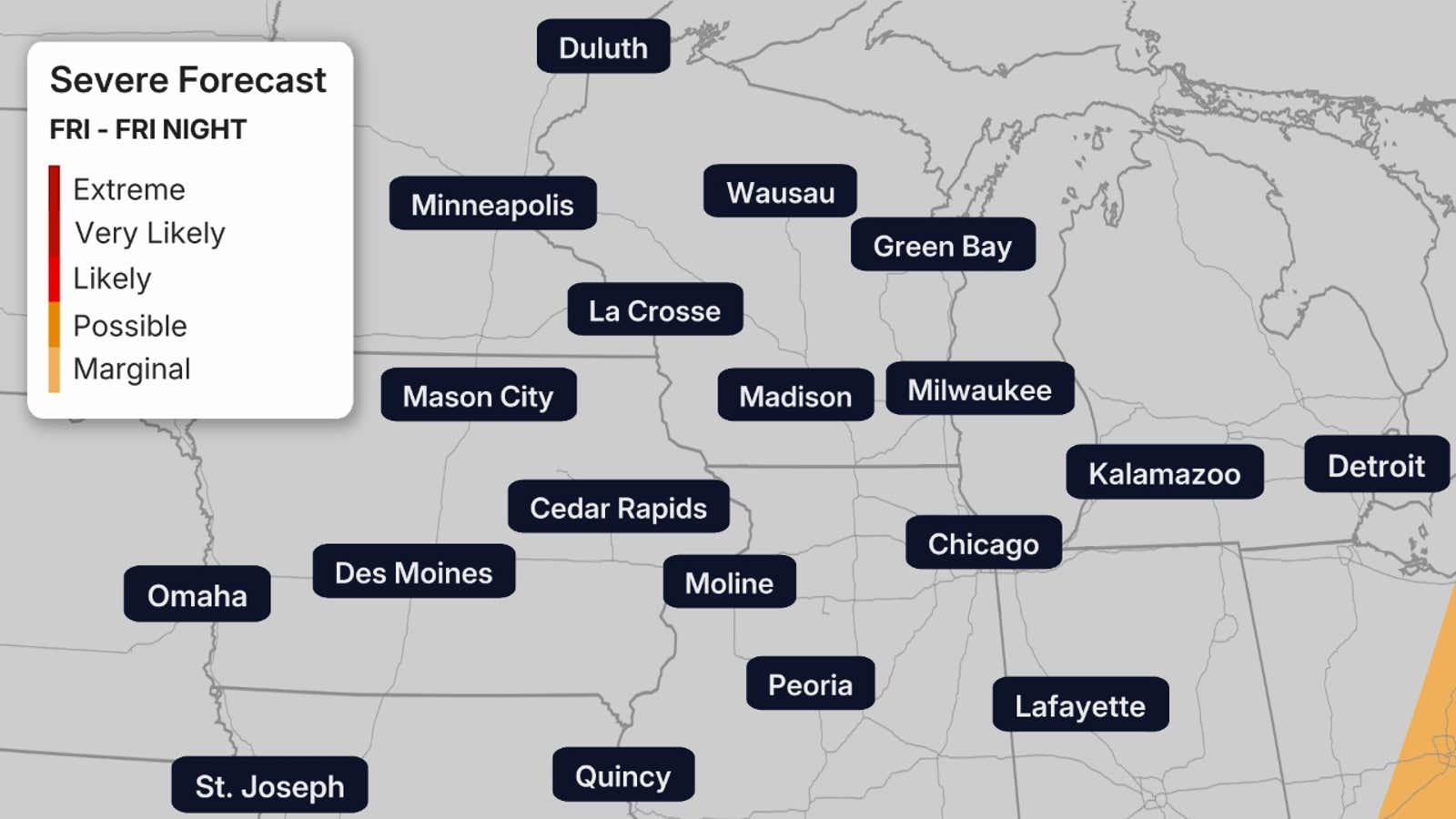
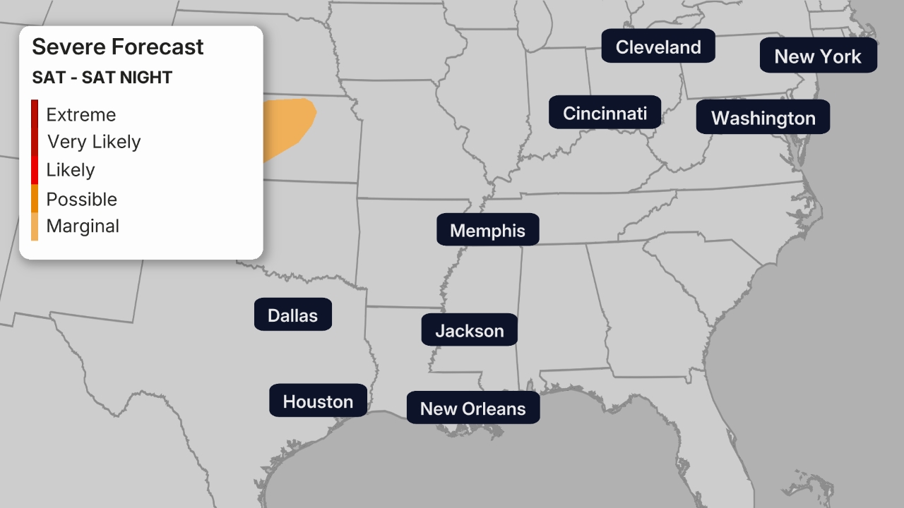
Severe Forecast
Friday
Unfortunately, a more serious threat of severe thunderstorms is in play Friday. And, once again, it’s from the Southern Plains to the upper Mississippi Valley.
Strong tornadoes — possibly as strong as EF3 — could develop in supercell thunderstorms this evening in parts of eastern Iowa, northwestern Illinois and western Wisconsin. A few strong tornadoes are also possible farther south ahead of the cold front from much of northern and western Missouri to eastern and southern Kansas, northern and western Oklahoma.
This threat is likely to transition into one or more squall lines of severe thunderstorms with damaging winds and embedded tornadoes, especially in the darker shaded areas in the maps below. These winds are capable of knocking down trees, possibly onto homes and vehicles, and power outages.
The Storm Prediction Center added an area with a “very likely” chance of severe storms from parts of Oklahoma into Kansas and Missouri, warning that strong converging air at the surface could fuel supercell thunderstorms capable of producing hail over 3 inches in size as well as downdrafts up to 85 miles per hour.
(MORE: How To Stay Safe In Severe Weather | Underrated Falling Tree Danger)
Saturday
There may still be at least some isolated to scattered severe thunderstorms ahead of a cold front Saturday in the eastern Great Lakes and Ohio Valley.
But we’re not expecting this activity to be nearly as widespread as Friday.
Fortunately, the nation should get at least a three-day break from severe weather as the cold front sweeps off the East Coast Sunday.
(MAPS: 7-Day US Rain/Snow Forecasts)
Flood Forecast
The combination of previous rounds of heavy rain and, in some areas, melting snow has already triggered serious flooding in parts of the western Great Lakes. Flooding is also possible as far south as Missouri due to heavy rain that will come with Friday’s squall line.
Some stretches of rivers in Michigan and Wisconsin are either in or forecast to crest in major flood stage.
Flood watches and flood warnings continue for the areas below.

We expect a swath from eastern Kansas and northern Oklahoma to the Southern Great Lakes to pick up another 1-inch-plus of rainfall through Saturday.
Where multiple rounds of thunderstorms or clusters of storms occur, locally heavier rainfall is expected. And that could lead to dangerous flash flooding, particularly in urban areas and those areas whose ground is already saturated.
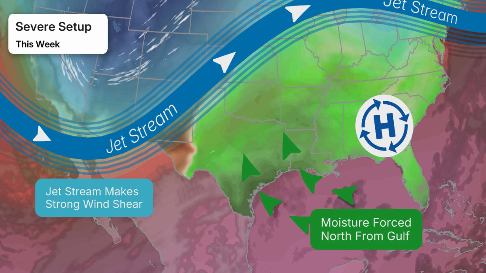
Why The Severe Parade?
What is going on here is actually pretty interesting. We have a high-pressure system that is sitting across the eastern U.S. This is forcing Gulf moisture to be pushed northward across the Plains.
We then have southward plunges of the jet stream, or troughs, pivoting out of the West into the Central Plains. Troughs like this generally bring severe weather.
Because of the high-pressure system across the East and the aforementioned troughs, severe weather may hit many of the same areas for days.
Recap
It’s been a daily pounding of severe weather so far in the Plains and Midwest, from Texas to the Great Lakes, and even parts of the Northeast.
There have been over 750 reports of severe weather from Monday through Thursday night, including almost 50 reports of tornadoes. The exact number of actual tornadoes is not yet clear, pending additional surveys from the National Weather Service.
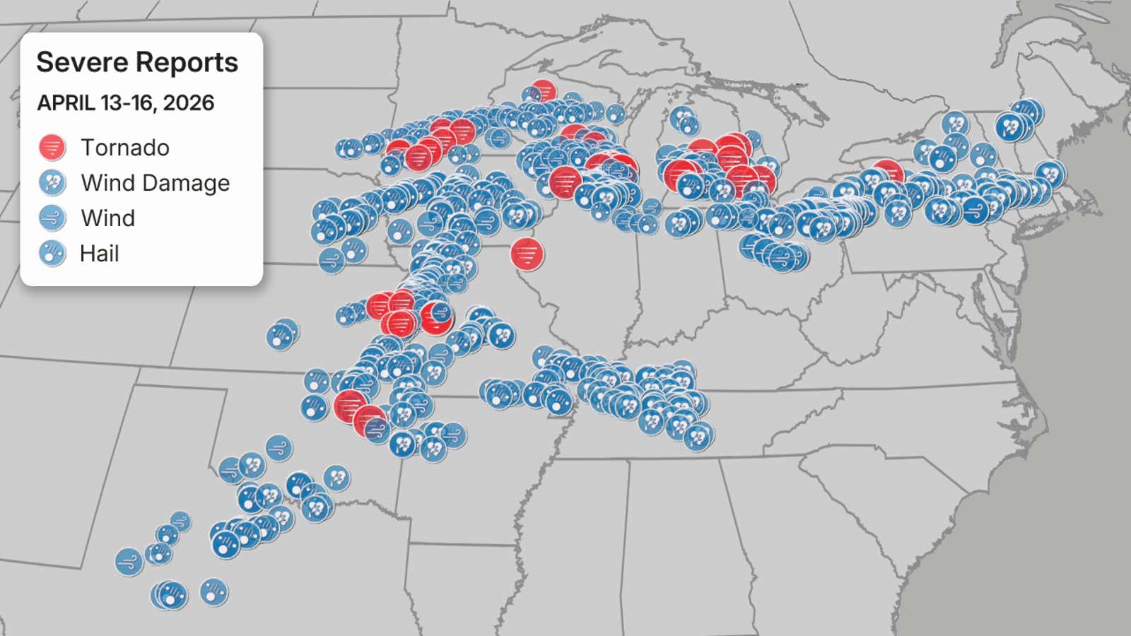
Reports of severe weather from early Monday morning through Thursday night. Plotted above are both reports of and confirmed tornadoes.
(Data: NOAA/NWS/SPC)
Monday and Monday night, there were 19 reports of tornadoes, including sighted tornadoes near Truman, Minnesota, in Taylor County, Wisconsin, and in Miami County, Kansas.
An EF2 was confirmed in Franklin County, Kansas.
Hail up to the size of baseballs or large apples was reported in several areas of southern Minnesota and eastern Kansas.
An overnight squall line of severe thunderstorms knocked out power to almost 90,000 customers in southern Wisconsin. Wind gusts removed the roof of a home in Jefferson, Wisconsin, and damaged siding in Burlington, Wisconsin.
Flash flooding stranded vehicles Monday night in Green Bay and Neenah, Wisconsin.
The combination of heavy rain, warmer air and snowpack has led to significant flooding in northern Michigan.
Flooding washed out a section of M-119, the “Tunnel of Trees” scenic highway north of Petoskey, Michigan.
Just south of Traverse City, Michigan, the Manistee River near Sherman, Michigan, already obliterated its previous record crest by over 2 feet in records dating to the Great Depression.
Gaylord, Michigan, not only topped its record wet April not even halfway through the month (8.25 inches), but also smashed its record wet spring (14.46 inches) just halfway through, as well.
Both Alpena (2.24 inches) and Houghton Lake (2.97 inches), Michigan, also had their wettest April day on record last Sunday.
Tuesday, a strong tornado destroyed a home near Union City, Wisconsin. The preliminary survey came back that this tornado was an EF3 with estimated peak winds of 140 mph. It was the strongest April tornado in Wisconsin in 15 years.
Another tornado confirmed by radar took multiple roofs off a commercial facility and damaged a church in the northwest Milwaukee suburb of Sussex and Lisbon. That tornado was rated an EF2.
Several tornadoes were documented by storm chasers in Iowa, including one captured in a 360-degree drone video near Wyoming, Iowa. At least one building was damaged near Masonville from a possible tornado.
Hail from golf ball to softball size pelted Dane County, Wisconsin, including the city of Madison, damaging at least 1,700 vehicles. Siding and roof damage were reported in Black Earth, Wisconsin.
The only other softball-size — 4-inch diameter — hail on record in Dane County prior to Tuesday was on July 2, 1960, according to NOAA’s Storm Events database.
Wind caused significant damage to farm buildings and wooden stakes were impaled into the ground in Delhi, Iowa, Tuesday evening. Winds gusted as high as 88 mph in Dubuque, Iowa, and 80 mph at Grand Rapids, Michigan.
High winds also lead to roof and structural damage near Chickasaw, Ohio.
In western Oklahoma, winds gusting to 84 mph blew large hail and caused structural damage in Elk City. High winds also damaged a home near Warren, Oklahoma.
Wednesday, wind-driven hail damaged some homes and vehicles in parts of Kansas, Nebraska and Ohio, including parts of the Cleveland metro area.
Wednesday night, a quick 2 to 4 inches of rain fell over saturated ground and triggered major flash flooding in Milwaukee, including around American Family Field, trapping motorists leaving from the Blue Jays – Brewers baseball game. It rained so hard that rain leaked through gaps in the roof of the stadium during the game.
Milwaukee, Wisconsin, has already broken its wettest April on record with a total so far of 7.57 inches.
Rob Shackelford is a meteorologist and climate scientist at weather.com. He received his undergraduate and master’s degrees from the University of Georgia studying meteorology and experimenting with alternative hurricane forecasting tools.

