Louisiana, Mississippi impacted by severe weather, flash flooding
Severe weather is looking more likely for southeast Louisiana and south Mississippi
Severe storms are moving over the New Orleans Metro Friday. Below are the current advisories and warnings in place.
Flash Flood Warning:
A Flash Flood Warning has been issued for Northeastern Jefferson Parish, Orleans Parish, and Plaquemines Parish until 6:15 p.m.
Severe Thunderstorm Warning:
A Severe Thunderstorm Warning has been issued for New Orleans, Jefferson Parish, St. Bernard Parish, St. Tammany Parish, Plaquemines Parish, and Hancock County, Mississippi until 4:30p.m.
Severe weather threat:
Keeping an eye on the radar late this afternoon/evening. There is now a slight risk or level 2 threat for severe weather.
This means that isolated to scattered severe storms are expected.
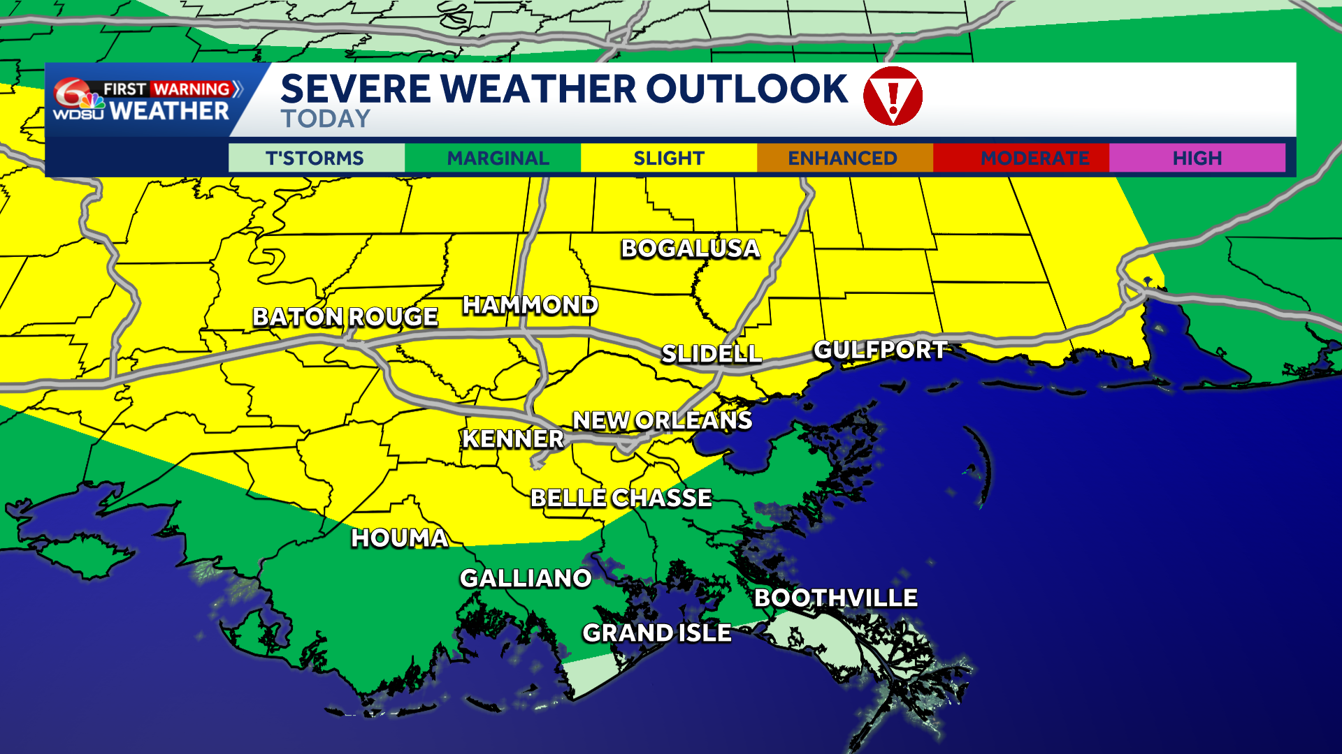
Severe Weather Outlook Today
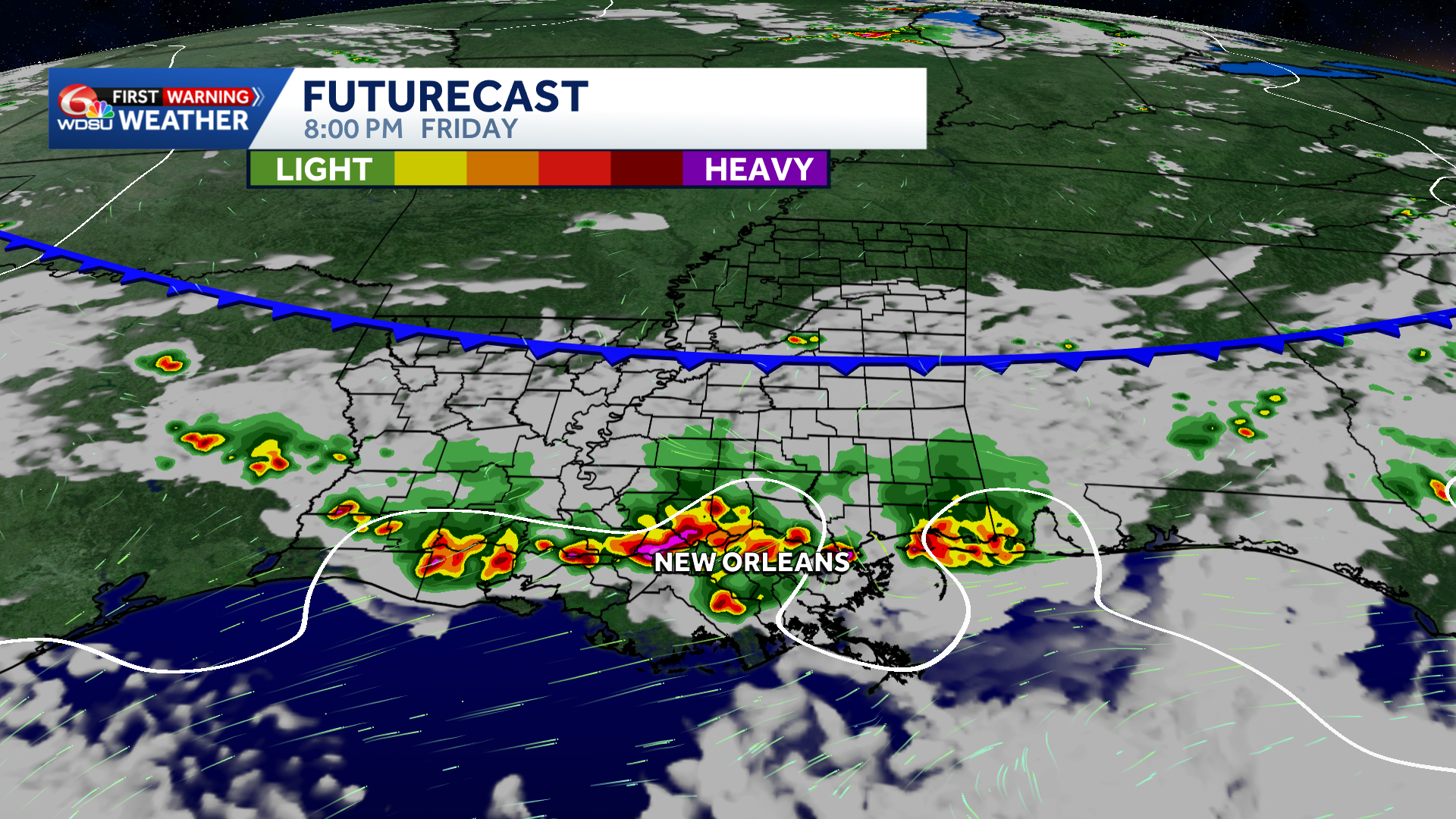
An upper level disturbance along with an approaching surface cold front will help lead to increased lifting to help with the development of strong to severe storms.
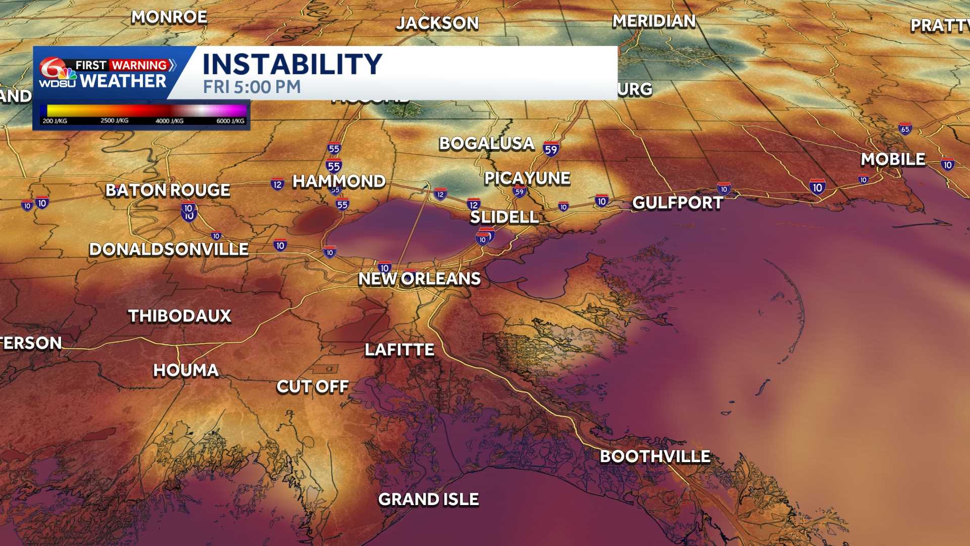
Moderate to strong instability will also be in place to help fuel possible severe weather too.
The main threat with today’s storms will be gusty/damaging winds along with a low end threat of flooding.
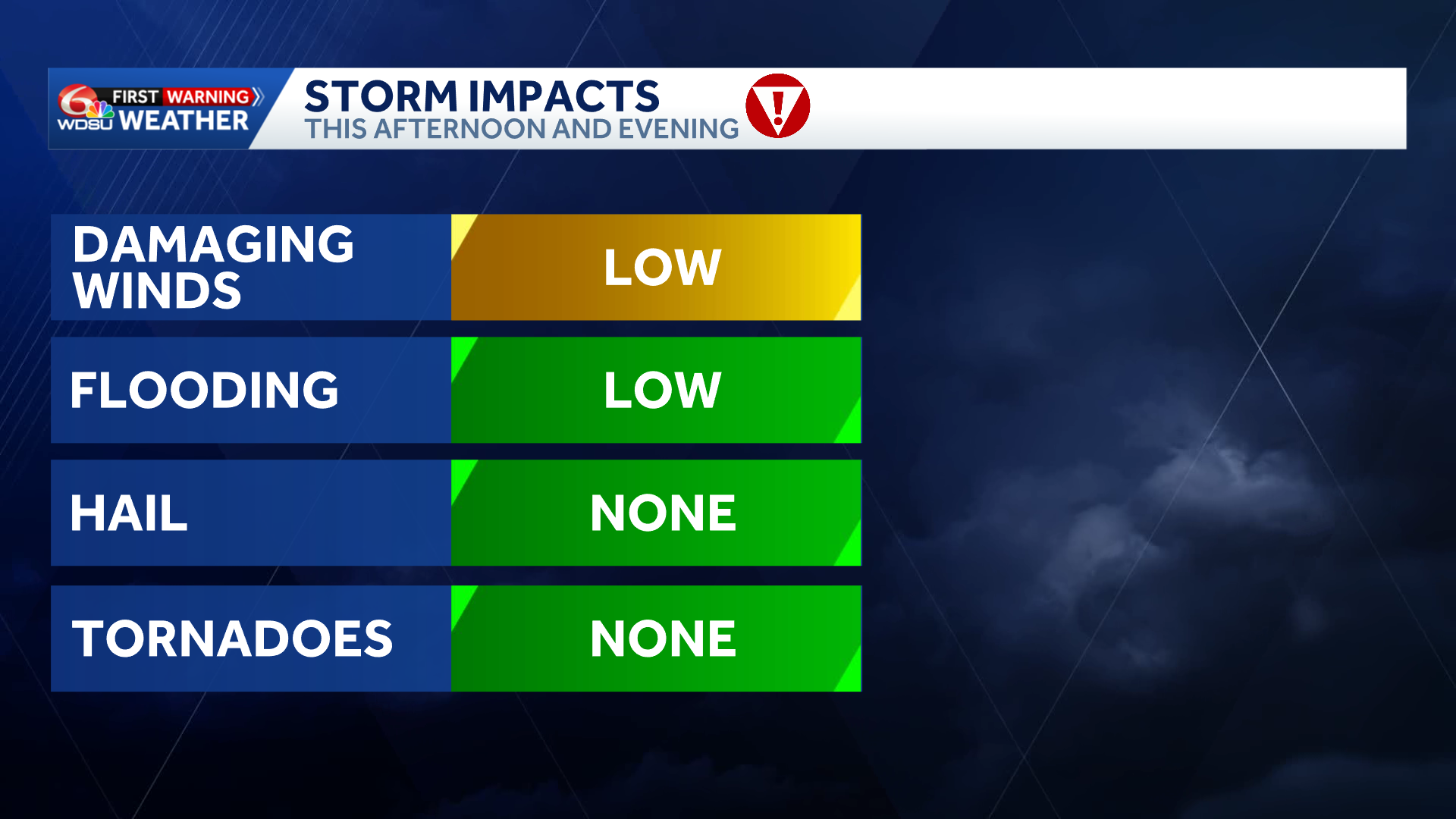
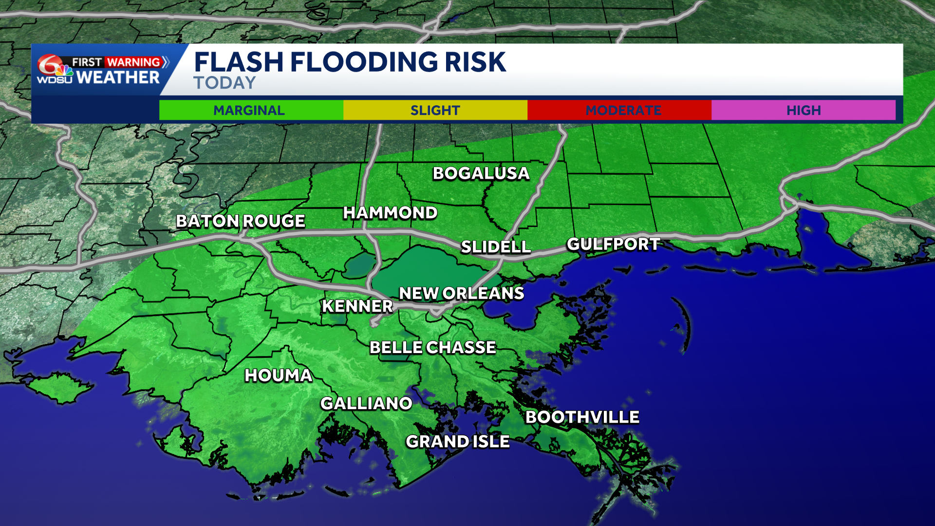
Strong storms could produce heavy rain leading to isolated flooding possible. Therefore, a level 1 marginal risk of flooding is in effect for all of southeast Louisiana and south Mississippi.
The main severe weather timing will start during the later afternoon hours and continue through the early evening.
Strong to severe storms will develop over south Mississippi and Northshore locations between 4pm-6pm.
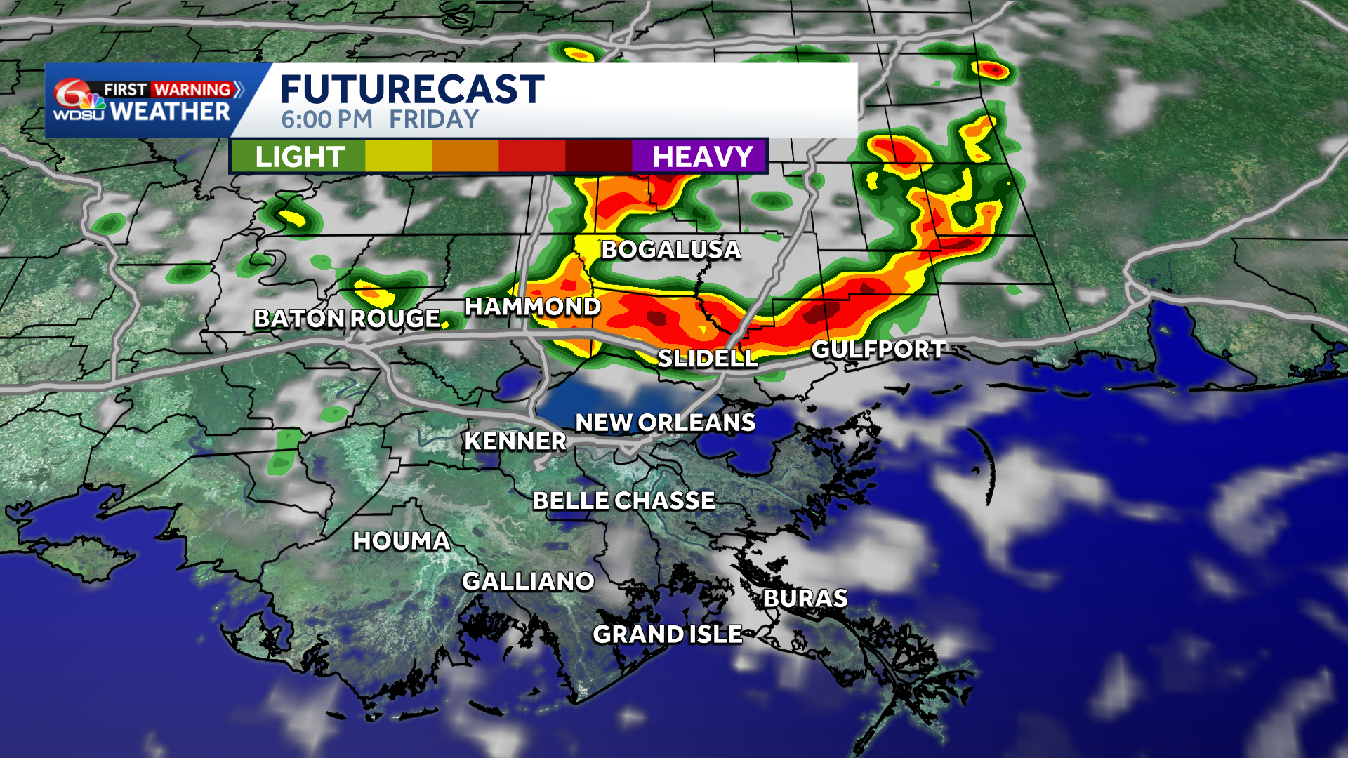
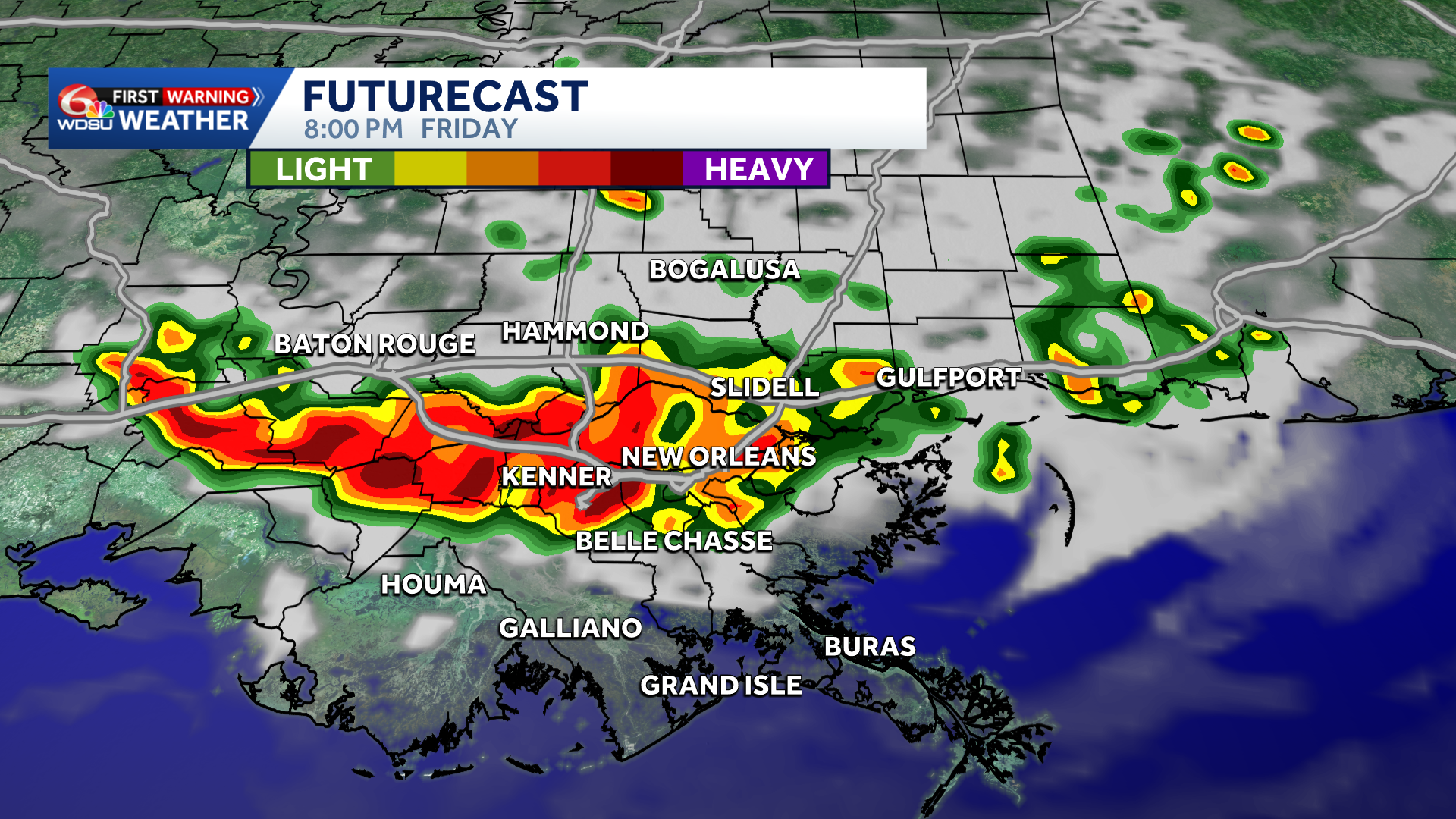
By 6pm-8pm, the storms develop into a strong line and move south toward the New Orleans Metro and River Parishes.
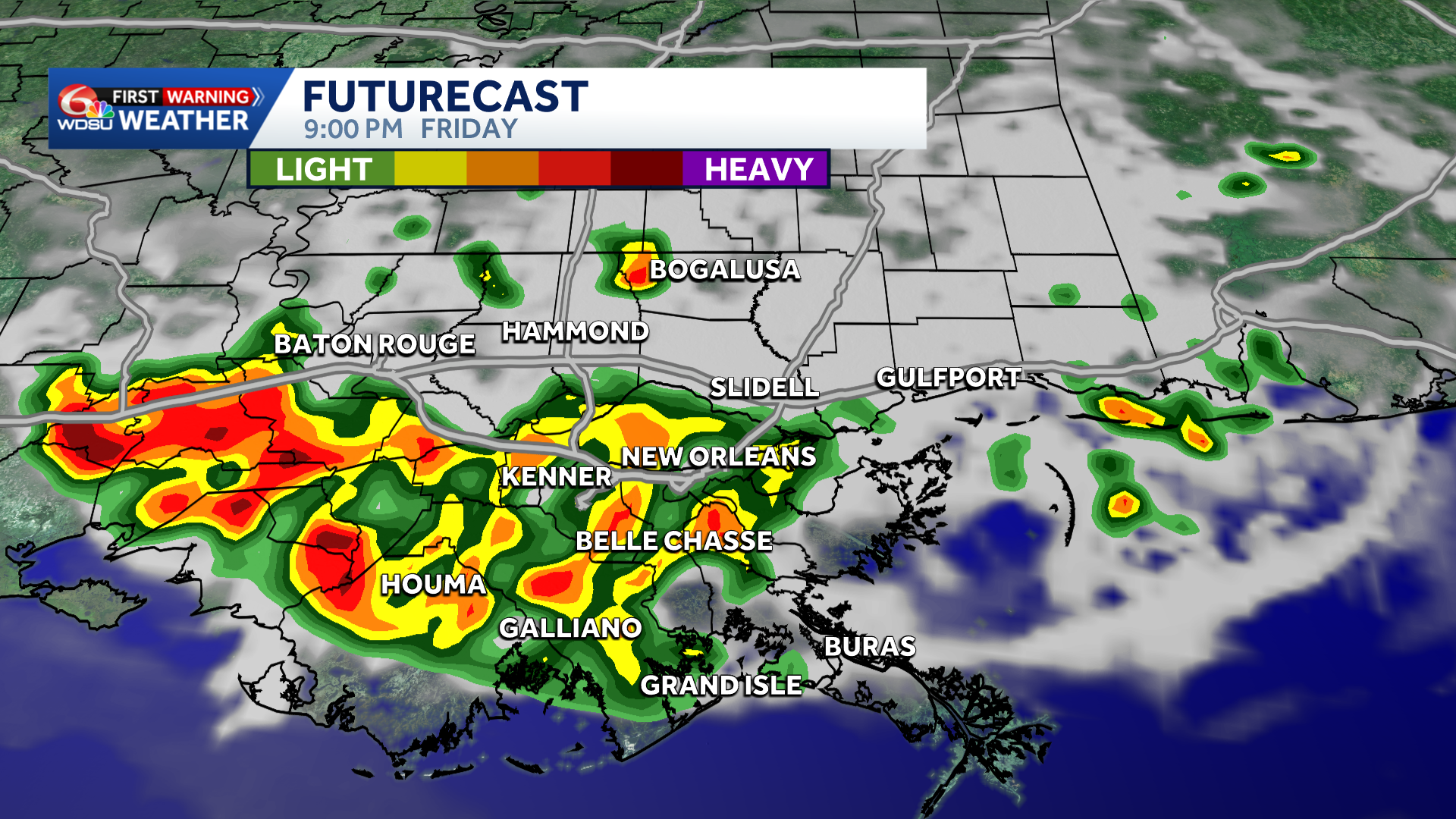
By 9pm-10pm, the line begins to move into the Bayou and coastal Parishes while weakening.
Stay with the WDSU First Warning Weather Team for the latest on this developing weather situation.